
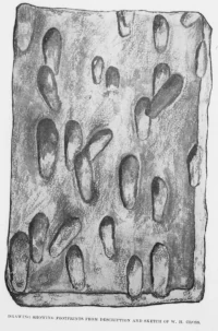
Indigenous peoples lived around the Lake Ontario basin for millennia before Europeans arrived, adapting as postglacial lake levels and shorelines changed at the end of the last Ice Age, around 12,000 years ago. Archaeological sites document fishing, hunting, plant gathering, trade, and eventually farming villages.
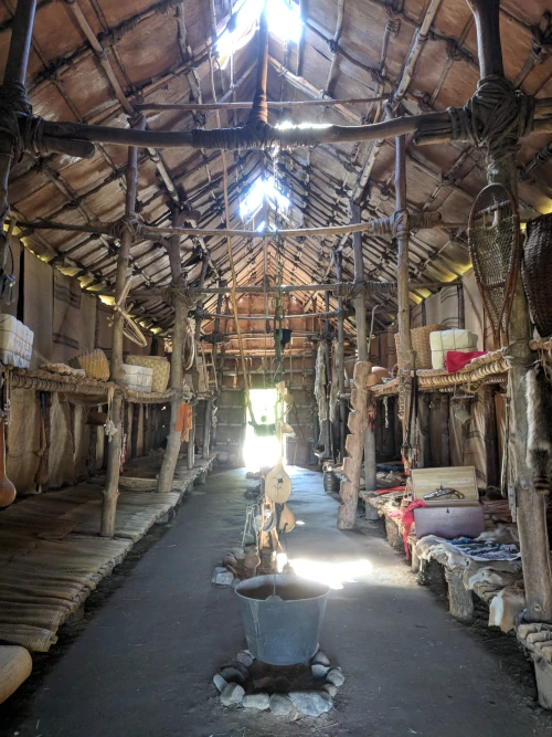
Mohawk tradition identifies the Bay of Quinte region as the birthplace of Tekanawí:ta - the Peacemaker - whose diplomacy led to the Great Law of Peace and the Haudenosaunee Confederacy in the 12th century. The Mohawks of the Bay of Quinte place this history at the heart of their relationship with the lake.
By approximately 1400-1450, substantial ancestral Wendat communities occupied the north shore, including the Grandview site. During the sixteenth and early seventeenth centuries, many north-shore communities coalesced and moved northward toward historic Wendake. Communities around the eastern lake and upper St. Lawrence River, often called St. Lawrence Iroquoians by archaeologists, also dispersed or joined other Indigenous nations. This was not a simple “disappearance”: descendants and refugees were incorporated into Wendat and Haudenosaunee communities, among others.
When Samuel de Champlain published his first detailed map of New France in 1612, he had never traveled on Lake Ontario but, he drew a recognizable body of water above the St. Lawrence River and represented Niagara Falls nearby. Library and Archives Canada describes this as the first map to portray Lake Ontario and Niagara Falls and notes that both were based on Native mapping.
Champlain didn't give the lake a proper name. Instead, his notation described it as a lake containing approximately “fifteen days” of travel by Native canoe. The old French wording is difficult to translate literally, but its significance is clear: the earliest European map of the lake presented it as a measured part of an Indigenous transportation system.
This wasn't unusual. European explorers depended on Native travelers for geographic information far beyond the territory the Europeans had personally visited. Canoe routes, portages, river junctions, distances, and the relative positions of lakes were communicated orally, by gesture and through maps drawn on bark, earth or other temporary surfaces. Champlain converted some of that knowledge into a printed European map, but the information wasn't simply his discovery.
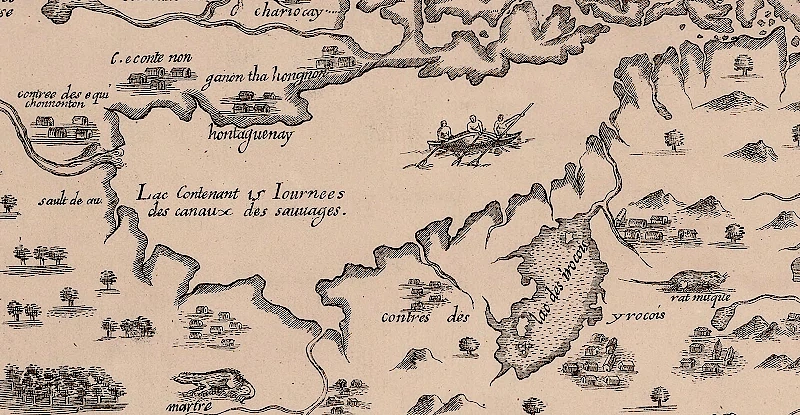
Champlain finally traveled across the region during a Wendat-led military expedition in 1615. His account, published in 1619, called the water le grand lac des Entouhonorons - “the great lake of the Entouhonorons” - and later le lac des Entouhonorons. This may be the earliest documented proper name clearly associated with Lake Ontario in the surviving European record. It's an ethnonym: a name for a people applied to the lake with which Europeans associated them. The precise identity intended by Champlain’s Entouhonorons has been debated, so it should not be casually translated as the name of one particular Haudenosaunee nation.
Other names soon appeared:
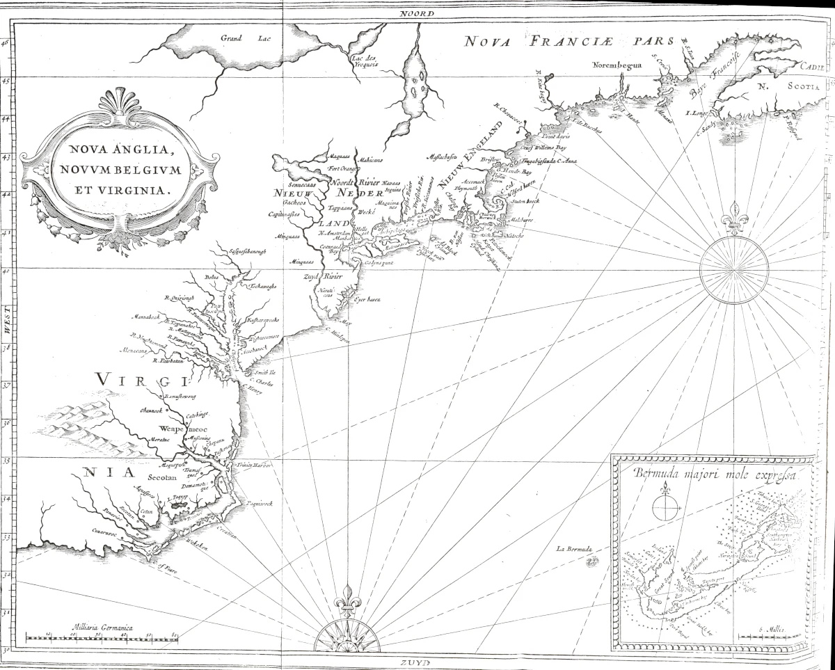
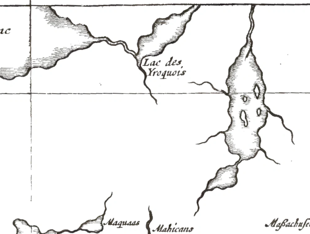
In a report dated May 19, 1641, by Jesuit superior Jérôme Lalemant, he refers twice to “the Ontario or lake of St. Louys” - l’Ontario ou lac de St. Louys. The context makes this especially significant. Lalemant was writing at Sainte-Marie during the Jesuit mission among Wendat people, and the report included information obtained during missionary travel among the Neutral people. Because Lalemant paired Ontario with a different name used by the French, his phrasing may document a name already used by Native people.
Paul Ragueneau’s Jesuit Relation for 1647-1648 makes the distinction still clearer. He wrote of “a third Lake, named Ontario, which we call Lake Saint Louys.” The contrast between “named Ontario” and “which we call” Saint Louis strongly suggests that Ontario did not originate with the French missionaries.
In July 1654, while traveling to Onondaga country as a missionary and peace emissary, Simon Le Moyne wrote of “a great lake called Ontario; we call it the Lake of the Iroquois.” On August 20, while returning from Onondaga country to Quebec, he again referred to “the great lake Ontario, called the lake of the Iroquois.” By then the name was circulating in other French writing, although French authors continued to use Saint Louis and other alternatives.
The documentary case is pretty strong. Lalemant’s 1641 wording comes from a Wendat and Neutral mission setting, and both Lalemant and Ragueneau’s 1647-1648 wordings separate Ontario from the name used by the French. A more explicit attribution comes from the Recollect missionary Louis Hennepin. In his 1683 Description de la Louisiane, Hennepin wrote of “a great lake which the Native people call Ontario, and the French [call] Frontenac.” Elsewhere he called it “Lake Frontenac, or Ontario, which means beautiful lake.”
Hennepin’s statement is direct, but still imprecise. His collective term for Native people doesn't identify a nation or speaker, but it does indicate that some Native people called it Ontario.
Modern Native leaders provide additional support. Wyandotte Nation Chief Billy Friend identifies Ontario with the Wendat form Ontari’io, translated as “the lake is beautiful” or “the lake is big.” Seneca Nation President J. Conrad Seneca identifies the traditional Seneca form sga:nyodai:yoh, “beautiful lake.” The spellings and English translations vary because related Iroquoian languages are not identical and because Europeans wrote Native sounds inconsistently.
We can say Ontario is an Indigenous place-name, probably Iroquoian and possibly from a Wendat or Neutral context. The surviving seventeenth-century documents don't show that every Native nation around the lake used the same word.
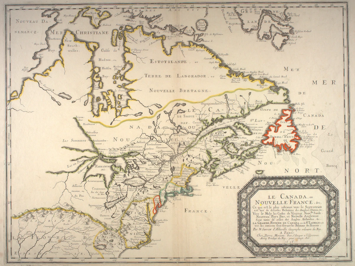
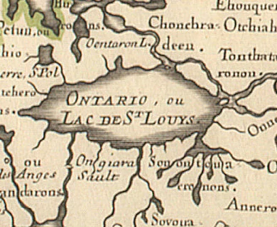
Nicolas Sanson’s 1656 map Le Canada, ou Nouvelle France labels the lake Ontario, ou Lake De St. Louys. Francesco Giuseppe Bressani’s 1657 map Novae Franciae Accurata Delineatio provides another early cartographic example. It labels the lake Ontario lacus seu Sanci Lvdovici - “Lake Ontario or [Lake] Saint Louis.” Another early map, François Du Creux’s Tabula Novae Franciae Anno 1660, labels the lake with an Ontario form. The map was dated 1660 and published with Du Creux’s history of Canada in 1664. Its Latin label for the lake is Lacus Ontarius.
An anonymous manuscript map, catalogued by the Bibliothèque nationale de France broadly to the 1660s, and associated with French fortifications in the vicinity, labels the lake “Lac Ontario ou des Iroquois.” Cataraqui, recorded in several French spellings including Katarakoui and Cataracoui, was in colonial documentary use by 1673. The “Journal of Count de Frontenac’s Voyage to Lake Ontario,” uses Katarakoui for the St. Lawrence River and the area around present-day Kingston. Modern interpretations of the Kanyen’kehá:ka place-name Ka’taroh:kwi include “a place with mud or clay” and “where limestone is,” but the exact historical etymology isn't settled. Colonial writers sometimes extended Cataraqui to the lake itself.
On a map made by Vincenzo Coronelli in 1688, the lake is labeled Lac Frontenac ou Ontario et Skaniadorio ou St. Louis. In English this is approximately “Lake Frontenac, or Ontario, and Skaniadorio, or Saint Louis.” Skaniadorio resembles forms in several Haudenosaunee languages that mean “beautiful lake” or “handsome lake,” including the Seneca sga:nyodai:yoh. It may represent another Iroquoian rendering of the same or a closely related descriptive idea preserved in Ontario.
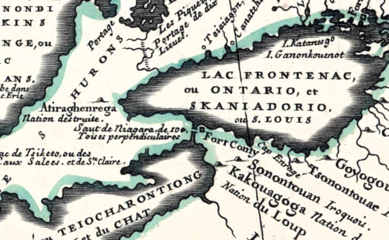
The alternative names carried different kinds of information. Saint Louis and Frontenac had French religious, royal, and colonial associations. Lake of the Entouhonorons and Lake of the Iroquois identified the water by reference to peoples whom Europeans associated with it. Cataraqui pointed toward its important eastern gateway. Ontario and Skaniadorio appear to preserve Indigenous-language descriptions of the lake itself.
These maps show that the names overlapped. They didn't succeed one another in a neat official sequence. No surviving document records a meeting where one name was formally chosen. Repetition did the work. Mission reports, travel narratives and maps made Ontario increasingly familiar, while the French names failed to displace it permanently.
The naming evidence makes more sense when Lake Ontario is understood as part of an Indigenous economy rather than simply as a boundary on later maps.
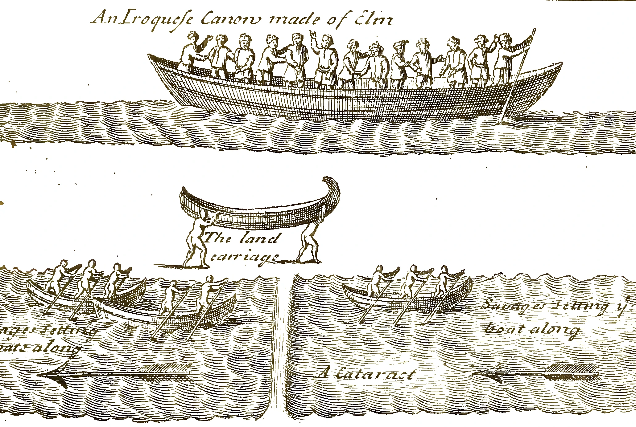
The lake and its tributaries connected the St. Lawrence River, the upper Great Lakes and the interior of what are now New York and Ontario. The Toronto Carrying Place linked the lake with Lake Simcoe and routes farther north and west. The Niagara portage bypassed the falls toward Lake Erie. The Cataraqui corridor opened onto the St. Lawrence and Ottawa systems. The Oswego River, Oneida Lake and the Mohawk River connected the southeastern shore with Haudenosaunee country and the Hudson Valley. The Trent system and Bay of Quinte joined the north shore to inland hunting, fishing and settlement areas.
People traveled these routes for diplomacy, visiting, ceremony, fishing, hunting and war as well as commerce. The Onondaga Nation describes Lake Ontario and the Oswego River system as historically, culturally and spiritually important and recounts their use for fishing, hunting, gathering and transportation long before European arrival. The Nation also explains that people of several Haudenosaunee nations could reach Grand Council meetings through the connected river and lake system.
Wendat communities were major agricultural producers and commercial intermediaries. Corn, beans, squash, tobacco, nets, tools and other goods moved among Native communities. Wendat traders exchanged agricultural products and manufactured goods with northern hunting peoples for furs. European metal, cloth, glass beads and weapons entered these existing networks; Europeans did not create the trade routes or the regional economy.
Ragueneau’s 1647-1648 Relation provides a revealing snapshot. He wrote that Wendat and neighboring Algonquin peoples traveled north to obtain furs and beaver skins. Describing diplomacy between Wendat and Onondaga representatives, he distinguished the material languages of exchange: Wendat delegates carried presents of furs, while Onondaga envoys brought collars of wampum.
The same account explains that a route across Lake Ontario toward the St. Lawrence would have been much shorter than the Ottawa River journey to the French settlements. Warfare made the direct route dangerous and forced Wendat travelers and missionaries onto a difficult course with scores of portages. Geography, trade, diplomacy and military security were intertwined.
While Ontario became increasingly common as a name for the lake, the middle decades of the seventeenth century also brought catastrophic upheaval. Introduced epidemics caused severe loss of life among the Wendat and neighboring peoples during the 1630s and 1640s. Disease interacted with food shortages, political divisions, missionary activity, and warfare.
In 1649-1650 Haudenosaunee attacks contributed to the breakup and dispersal of the Wendat confederacy in its Georgian Bay homeland. Neutral communities west of Lake Ontario were attacked and dispersed during the early 1650s. Survivors didn't disappear. They joined other Native communities, moved to new locations and maintained identities that continue in descendant nations, including the Huron-Wendat Nation and Wyandot or Wyandotte nations.
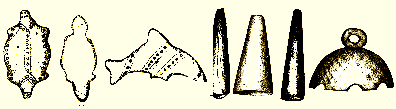
The political geography around Lake Ontario consequently changed. During the later seventeenth century, Haudenosaunee communities occupied several places along the north shore. French records mention settlements including Ganatsekwyagon or Gandatsetiagon near the Rouge River and Teiaiagon near the Humber River. Archaeology at Bead Hill preserves evidence of a Seneca community occupied approximately 1665-1687: glass beads, gunflints and copper-kettle fragments occur with pipes and wampum. The site wasn't an isolated colonial outpost. It was a Native town participating selectively in regional and transatlantic exchange.
By the end of the century, Anishinaabe peoples, including ancestors of the Mississaugas of the Credit, were establishing or reestablishing communities around the lake. The Mississaugas of the Credit First Nation’s own history places their ancestors in stewardship of a large territory at the western end of Lake Ontario by the late seventeenth century and describes a territory connected by waterways and trails. The Nations around the lake changed, but the lake continued to be Native space.
France established Fort Frontenac at Cataraqui in 1673. Successive French works at Niagara beginning in 1679 and a permanent fort constructed in 1726 sought to control the western passage. British traders established a post at Oswego in the 1720's. These were military installations, but they were also efforts to redirect commerce conducted through Native transportation corridors.
The forts could not simply command that commerce. Native nations decided whether to visit a post, where to take their pelts, what alliances to maintain, and what prices, presents or diplomatic concessions to demand.
A 1674 report from Governor Frontenac is unusually candid about that dependence. He complained that Haudenosaunee trade with Odawa people at Gandaschekiagon, a north-shore community, could carry furs toward Dutch merchants and “ruin” French trade. Frontenac claimed that his new fort and diplomacy had stopped it. This boast shouldn't be accepted at face value - his report was written to justify his policies, and he described retaining eight children from prominent Haudenosaunee families as hostages guaranteeing the peace - but his complaint itself reveals the underlying reality. The French feared commercial routes they did not control.
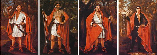
The same pattern continued as French, Dutch and British interests competed. Native people carried goods and information among rival markets and used trade as part of diplomacy. A fort flourished only if Native traders considered it useful, safe or politically advantageous.
That relationship is unusually visible in a map printed in New York in 1724. Cadwallader Colden’s A Map of the Countrey of the Five Nations labels the lake CATARAQUI OR ONTARIO LAKE. William Bradford printed it with Papers Relating to an Act of the Assembly of the Province of New-York, for Encouragement of the Indian Trade.
The full title explains the conflict: the New York law was intended both to encourage the colony’s “Indian Trade” and to prohibit the sale of trade goods to the French in Canada. London merchants petitioned the king against the restriction. New York officials answered that French merchants were using cheaper goods obtained through New York to secure Native trade and influence. Colden’s map accompanied arguments about the routes connecting Albany, the Haudenosaunee nations, Lake Ontario, the western lakes and Canada.
The publication wasn't a neutral atlas. It was part of a transatlantic dispute over who could supply Native markets and profit from Native commercial networks. Its geography was an argument: New York officials wanted to demonstrate that water routes through Haudenosaunee country gave their colony access to nations farther west and that the French could be challenged for the fur trade.
The document’s language treated Native nations as objects of imperial competition, but it simultaneously acknowledged their power. One passage described western nations as people “who assert their own Freedom, and declare themselves Friends to those that supply them best with what they want.” The wording was self-interested, yet it recognized that Native nations were not simply assigned to one empire’s trade. They made choices among competing partners.
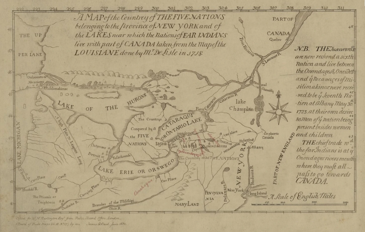
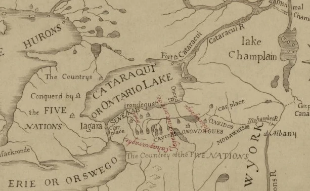
The map is often identified as the first map engraved in New York. It may be the earliest known map printed in what later became the United States that labels the lake with Ontario.
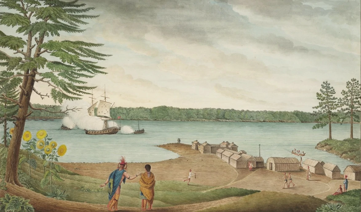
The imperial rivalry visible in the 1724 trade dispute eventually became part of open warfare. During the French and Indian War (1754-1763) - the North American phase of the wider Seven Years’ War - Britain and France fought for territory, trade, and control of the routes through Lake Ontario and the St. Lawrence. Indigenous nations and communities participated according to their own alliances and interests. British forces destroyed Fort Frontenac in 1758, captured Fort Niagara in 1759, and advanced down the St. Lawrence toward Montreal in 1760.
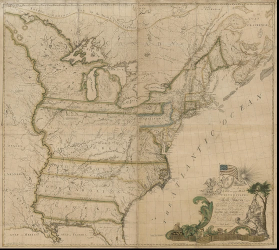
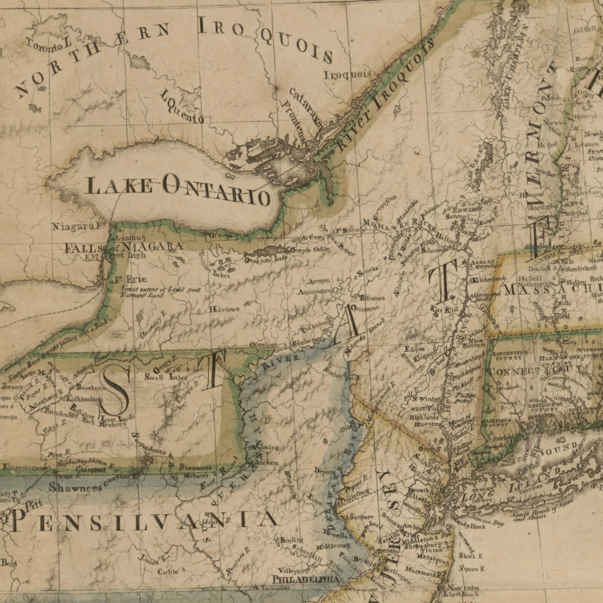
By the time the United States existed, "Lake Ontario" was already conventional English usage. The 1783 Treaty of Paris, which ended the American Revoultion with Great Britain recognizing the independence of the United States, used the words “Lake Ontario” in describing the international boundary. Abel Buell's A New and Correct Map of the United States of North America, the first map of the United States compiled, printed and published in America by an American in 1784, identifies "LAKE ONTARIO" - but not New York State.
The U.S. government did not create a standing geographic-naming authority until President Benjamin Harrison established the United States Board on Geographic Names in 1890. The First Report of the United States Board on Geographic Names, 1890–1891, published in 1892 uses the name Lake Ontario. Its decision list describes such features as “Braddock Point. Lake Ontario, New York,” “Devils Nose. Lake Ontario, New York,” and “Sacketts Harbor. Lake Ontario, New York.”
The report contains no separate naming decision for Lake Ontario. It uses the lake as the accepted location of smaller features. The Board’s comprehensive later decision lists likewise provide no evidence that it formally chose the name. The Board appears to have treated Lake Ontario as settled by long-established usage.
That is a useful distinction. Governments eventually standardized the spelling and used the name in treaties, reports and maps, but that isn't the same as creating it.
No single person gets credit for naming Lake Ontario, and no known geographic board or government officially bestowed the name on the lake. The best reading of the evidence is that French missionaries and travelers recorded an Indigenous word - probably Iroquoian and possibly learned in a Wendat or Neutral setting - while the French continued for decades to use alternatives such as Saint Louis and Frontenac.
The evidence has limits. We don't know the name of the Native person who first explained Ontario to a European writer. We can't demonstrate that all Native nations around the lake used one form or assigned it precisely the same meaning. Even “beautiful lake,” “great lake” and “lake of shining waters” may represent different ways of translating related words rather than one fixed English definition.
What survives is still remarkable. The first European map portrayed the lake through information supplied by Native people and measured it by Native canoe travel. The first recorded proper name connected it to Native people. The earliest verified use of Ontario appeared in a mission report produced amid Wendat and Neutral communities. Later maps preserved both Indigenous and colonial alternatives. Even a map printed for a British colonial trade dispute revealed that Native nations controlled the commercial choices on which European ambitions depended. And Lake Ontario is recognized on the first "American" map printed in a newly recognized United States.
Lake Ontario wasn't an anonymous geological feature waiting to be discovered, labeled, or opened to commerce by Europeans. It was part of a known, named, and inhabited geography - and one of its Indigenous names endured.
Sources
(Click to open/close the list)
Native Nations and Native Language Authorities
Onondaga Nation, “The Onondaga Nation’s and
the Haudenosaunee’s Historical Connection to Lake Ontario”. Native-authored account of Onondaga geography, fishing, travel, diplomacy and place-names around the lake.
Onondaga Nation, Petition to the Inter-American Commission on Human
Rights, 2014. The Nation’s account of its land, history and use of Lake Ontario’s region; cited as a Native legal-historical source. (PDF)
Mohawks of the Bay of Quinte, “History”. Native-authored account of the Bay of Quinte as the
birthplace of the Peacemaker and of the Great Law of Peace and the Haudenosaunee Confederacy.
Mississaugas of the Credit First Nation, “Treaty Lands and Territory” and
MCFN Timeline. The Nation’s account of its ancestors’ settlement and territory around Lake Ontario.
Wyandotte Nation, Statement
by Chief Billy Friend on the Wendat origin and meaning of Ontario, 2026. Used for the Wendat form and translation.
Seneca Nation, “Seneca Nation President Addresses President Trump’s Call to Rename Lake Ontario”, 2026. Used only for President J. Conrad Seneca’s identification and translation of the
traditional Seneca name.
Seventeenth-century Primary Sources
Samuel de Champlain, Voyages et descouvertures faites en la Nouvelle France, depuis l’année 1615 jusques à la fin de l’année 1618 (Paris: Claude Collet, 1619); the historical form lac des
Entouhonorons is indexed in the Trésor de la langue française au Québec. See
also Voyages and Explorations, 1615–1618, English translation, for the 1615 expedition and geography.
Jean de Brébeuf, Relation of 1635, in The Jesuit Relations and Allied Documents,
vol. 8. The passage uses lac des Hiroquois.
Jérôme Lalemant, Relation of 1640–1641, in The Jesuit Relations and Allied Documents,
vol. 21. The report twice uses “the Ontario or lake of St. Louys.”
Paul Ragueneau, Relation of 1647–1648, in The Jesuit Relations and Allied Documents,
vol. 33. Used for “named Ontario, which we call Lake Saint Louys,” the travel routes, Wendat trade and Wendat-Onondaga exchanges.
Simon Le Moyne, journal of 1654, in The Jesuit Relations and Allied Documents, vol. 41, pp. 93–95. Used for “a great lake called Ontario; we call it the Lake of the Iroquois” and the
corresponding entry from his return journey.
Louis Hennepin, Description de la Louisiane, 1683. Used for his explicit statement that Native people
called the lake Ontario while the French called it Frontenac, and for his “beautiful lake” interpretation.
Louis de Buade, comte de Frontenac, “General Memoir … on the State of Canada in 1674,” in
Documents Relative to the Colonial History of the State of New-York, vol. 9, pp. 116–118. Used for the north-shore trade with Odawa people, Dutch competition and
Frontenac’s claims about Fort Frontenac.
Later Primary Documents and Government Records
Cadwallader Colden et al., Papers Relating to an Act of the Assembly of the Province of
New-York, for Encouragement of the Indian Trade (New York: William Bradford, 1724). Used for the trade dispute, the accompanying map and the quoted description of western nations as
free to choose their suppliers.
Treaty of Paris, 1783, contemporary
printed copy in the Library of Congress. Used for “Lake Ontario” in the description of the international boundary.
United States Board on Geographic Names, First Report of the United States Board on
Geographic Names, 1890–1891 (Washington: Government Printing Office, 1892). Used to show that the Board treated Lake Ontario as an established locator rather than recording a separate
decision for the lake.
United States Geographic Board, Sixth Report
of the United States Geographic Board, 1890–1932 (Washington: Government Printing Office, 1933). Consulted as the later comprehensive decision list.
U.S. National Archives and Records Administration, “Records of
the U.S. Board on Geographic Names”. Used for the Board’s establishment by executive order in 1890.
Archaeology, Geography and Historical Interpretation
Heritage Toronto, “Ancient Footprints” and J. Ross Robertson, “Geological
Find under Toronto Bay” (1911). Used for the 1908 discovery, the destroyed prints, the proposed age and the history of the drawing.
Ronald F. Williamson, Shaun J. Austin and Stephen C. Thomas, The Archaeology of the Grandview Site: A Fifteenth Century Iroquoian
Community on the North Shore of Lake Ontario (Toronto: Archaeological Services Inc., 2003). Used for the Grandview site and its approximate 1400–1450 date.
Jennifer Birch, “Current Research on the Historical Development of
Northern Iroquoian Societies,” Journal of Archaeological Research 23 (2015): 263–323. Used for ancestral Wendat coalescence and the dispersal and incorporation of St. Lawrence
Iroquoian communities.
Gary Warrick and Louis Lesage, “The Huron-Wendat and
the St. Lawrence Iroquoians: New Findings of a Close Relationship,” (PDF) Ontario Archaeology 96 (2016): 133–143. Used to check relationships among ancestral Wendat and St. Lawrence
Iroquoian populations.
Ontario Archaeological Society, “Summary of Ontario
Archaeology”. Used as an overview of postglacial Indigenous occupation, subsistence and the eventual development of farming villages in southern Ontario.
Parks Canada, Bead Hill National Historic Site of Canada. Official
designation record for the Seneca village occupied approximately 1665–1687 and for glass beads, pipes, gunflints, metal kettle fragments and wampum found at the site.
Robert von Bitter, ed., The History and Archaeology of the Iroquois du Nord (Ottawa:
University of Ottawa Press, 2023). Used for the later seventeenth-century Haudenosaunee communities on the north shore of Lake Ontario and their archaeological context.
U.S. National Park Service, “Early Military History
of the Oneida Carry”. Used to check the relationship among the Oneida-Oswego corridor, Fort Niagara and the British trading post at Oswego.
Parks Canada, Fort Frontenac National Historic Site of Canada, and
Old Fort Niagara, “Old Fort Niagara’s Long History”. Used for the
construction dates and strategic and commercial purposes of the French forts.
Government of Ontario, “Indigenous Culture and History Along the Trans Canada Trail”. Used for the Toronto Carrying Place and the
older network of Native trails and trade routes; the page notes its development with Indigenous partners.
City of Kingston, “Ka’taroh:kwi: The Original Name and Original Languages of this Land”, and
Alderville First Nation Black Oak Savanna, “Katarokwi Placekeeping”. Consulted for
current interpretations of the Kanyen’kehá:ka place-name.
Ivan H. Walton, “Origin of Names on the Great Lakes,” (PDF) Names 3, no. 4 (1955): 241–249. Consulted for early lake names and
historical interpretations of Ontario and Skaniadorio.
Conrad E. Heidenreich, Huronia: A History and Geography of the Huron Indians, 1600–1650 (McClelland and Stewart, 1971). Used as background on Wendat geography, settlement and trade.
The Canadian Encyclopedia, “Wendat (Huron)” and “Fur Trade in Canada”.
Reliable secondary overviews used to check the larger economic context.
Maps and Image Rights
Daniel Penfield, Ganondagan Recreated Longhouse, 2018.
Wikimedia Commons, CC BY-SA 4.0.
Samuel de Champlain, Map
of New France, 1612, with Library and Archives Canada description. Used for the first European cartographic representation of Lake Ontario and Niagara Falls, the “fifteen days”
notation and the map’s reliance on Native geographic information. Public domain.
Johannes de Laet and Hessel Gerritsz,
Nova Anglia, Novum Belgium et Virginia, 1630, Colonial Williamsburg Foundation. Used for the Grand Lac and Lac des Yroquois labels and attribution. Public domain.
Jan Jansson, Nova Anglia, Novum Belgium et Virginia, 1639 atlas issue, Maine State
Archives. Used for Jansson’s close derivative of de Laet’s regional map. Public domain.
Henricus Hondius, America Septentrionalis, first
issued 1636, Wisconsin Historical Society. Used for the continental map’s publication history and Lac des Iroquois label. Public domain.
Samuel de Champlain, Map of New France, 1632, Bibliothèque nationale de France. Used for Lac St. Louis. Public domain.
Nicolas Sanson, Le
Canada, ou Nouvelle France, 1656. Used for the paired Ontario/Saint Louis label. Public domain.
Francesco Giuseppe Bressani, Novae Franciae Accurata Delineatio, 1657, Library of Congress.
Used for Ontario lacus seu Sanci Lvdovici. Public domain.
François Du Creux, Tabula Novae Franciae Anno
1660, Bibliothèque nationale de France. Public domain.
Anonymous, Map of part of New France, approximately
1660–1669, Bibliothèque nationale de France. Public domain.
Vincenzo Coronelli, Western Canada/New France map detail, 1688. Public domain.
Louis-Armand de Lom d’Arce, baron de Lahontan, Engraving of a Haudenosaunee canoe portage,
published in New Voyages to North-America (1703), Library of Congress. Public domain.
William M. Beauchamp, Wampum and Shell Articles Used by the New York
Indians, New York State Museum Bulletin 41 (1901), plate 6; and Metallic
Ornaments of the New York Indians, New York State Museum Bulletin 73 (1903). Public domain.
John Verelst, Four
Indian Kings of the New World, 1710. Four oil-on-canvas portraits of Etow Oh Koam, Sa Ga Yeath Qua Pieth Tow, Ho Nee Yeath Taw No Row and Tee Yee Neen Ho Ga Row, painted during their
diplomatic visit to London. Library and Archives Canada; composite image via Wikimedia Commons. Public domain.
Cadwallader Colden, A Map of the Countrey of the Five Nations, printed by
William Bradford in 1724; Yale University Library catalogue record. The article reproduces an 1882 public-domain facsimile.
Thomas Davies, A View of Fort La Galette, Indian Castle, and Taking a
French Ship of War on the River St. Lawrence, 1760, National Gallery of Canada. Public domain.
Abel Buell, A
New and Correct Map of the United States of North America: Layd Down from the Latest Observations and Best Authorities Agreeable to the Peace of 1783, New Haven, 1784. Library of
Congress, on deposit from David M. Rubenstein; high-resolution image via Wikimedia Commons. Public domain. The map’s significance and provenance are documented in
the Library of Congress exhibition.

