![]()
![]()

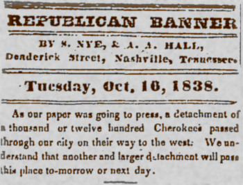
In 1838 most of the Cherokee being forcibly removed to Indian Territory traveled through the Nashville area on the Trail of Tears. They were accompanied by 518 Muscogee Creeks and an undetermined number of African American slaves. The first of 11 groups, or detachments, left Blythe's Ferry on the Tennessee River in Meigs County, Tennessee on October 1st, and passed through downtown Nashville on or around October 15th, 1838. The last detachment came through on December 2nd, 1838. Two more detachments that traveled by land, one lead by John Bell and the other by John Benge, traveled through Tennessee but didn't come through Nashville.
The main route followed by the Cherokee through Nashville entered southeastern Davidson County on Murfreesboro Pike and continued on to Lafayette Street, then turned north on Market Street, now called 2nd Avenue South, and continued to the Public Square. From there it crossed the Cumberland River on the Nashville Toll Bridge, then turned north along the river on what was then Old Whites Creek Road. It followed that road to the northwest and eventually crossed into what is now Cheatham County.
Four detachments left the main route after passing through Readyville and traveled north of Murfreesboro through the town of Jefferson. The route they followed re-entered Davidson County near where the Four Corners Marina now stands and followed Hamilton Church Road back to Murfreesboro Pike where it rejoined the main route. See our Old Jefferson Site page to learn more about this alternate route.
There were about 1,000 people in each detachment, although the last detachment numbered more than 1,700. They had wagons, pulled mainly by oxen teams, but these were used for hauling supplies and for anyone too sick or weak to walk. Some rode horses, but most traveled on foot, even though many were ill, having spent a brutal summer in concentration camps in southeast Tennessee, North Carolina, Georgia, and Alabama.
The Cherokee had been driven from their homes at gunpoint into those concentration camps by the U.S. Army and state militia, but the Cherokee detachments that came through Nashville did not have military escorts. After 2 of the 3 detachments that traveled by steamboat to Indian Territory under the Army's supervision experienced high death tolls, Chief John Ross and other Cherokee leaders convinced General Winfield Scott, who commanded the Cherokee removal, to let them take charge of moving their people to the west. The Cherokee Light Horse police force was responsible for security on the Trail.
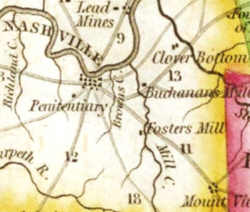
Cities like Nashville were resupply points for food, clothing, tents, and blankets along the Trail route, and the detachments also bought supplies along the way. They often camped near grain mills and one of these, Foster's Mill, was about 4 miles away from Nashville on Murfreesboro Pike at Mill Creek. Newspaper accounts at the time specifically mention the Cherokee camping at Foster's Mill. Based on research by the late Nashville historian Mike Slate and the Native History Association, the probable location of the campsite is a residential area on a hill located in a triangular area between Murfreesboro Pike, Mill Creek, and Interstate 24.
On November 25, 1838, a church service described in the journal of Daniel Butrick, a Christian missionary who accompanied the Cherokee to Indian Territory, was held in a church near the Foster's Mill camp site. Butrick doesn't identify the church or the minister who invited Butrick to hold the services there, but based on our research, and that of Mr. Slate, we believe the church was the historic Mill Creek Baptist Church that once stood near the intersection of Dodge Drive and Old Glenrose Avenue, and the minister was James Whitsett, a prominent member of Nashville's religious community in the 19th century.
A significant number of Cherokees were Christians. Evan Jones, a Baptist missionary who made the journey with the Cherokee, took over as the conductor of the 5th detachment when the first conductor, Chief Situwakee, became ill. The 5th detachment had overtaken and passed the 3rd detachment, lead by Jesse Bushyhead, after their oxen became sick after eating ivey, so the 3rd and the 5th detachments were in the Nashville vicinity around the same time in early November. There were a total of around five hundred Baptist Cherokees in the two detachments. The Baptist, a monthly newspaper published in Nashville, gives an account of a service held on November 5th where Jones, Bushyhead, and two other Cherokees named Dta-ske-ge-de-hee, and Aht-zthee, sang hymns and addressed the congregation in Cherokee with English translations. Apparently Chief Situwakee and 3 other Cherokees – Oganiah (Peter), Ganetuh (John Wickliffe), and Dsagee - were supposed to be there but were sick. At the end of the service a spontaneous collection took in $15.18 for the Cherokee Baptist mission. On November 7th Jones and Bushyhead returned and addressed the crowd, which was much larger than expected, once more. Another collection was taken up for another $14.62 for the Cherokee mission.
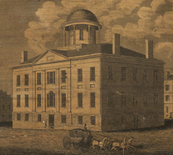
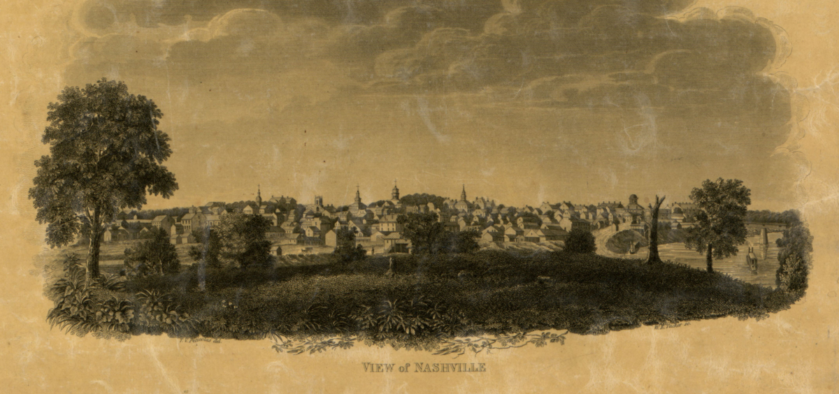
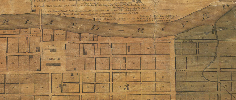
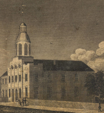
When each detachment left the Foster's Mill camp site, they traveled the 4 miles into downtown Nashville. When they reached the Public Square they would have stopped and lined up to cross the river on the Nashville Toll Bridge, a covered bridge that opened in 1823 and was the only bridge over the river at the time. The bridge rules only allowed 10 horses, mules, or cattle, or 20 hogs, on the bridge at one time, and loaded wagons had to stay 100 yards apart. The rules didn't address how many humans could be on the bridge at one time, but the gate keeper probably would not have let 1,000 or so people to cross at the same time. This meant there would have been some delay as each detachment crossed the bridge. One newspaper article at the time remarked on the good behavior of the Cherokee as they “loitered” on the Public Square.
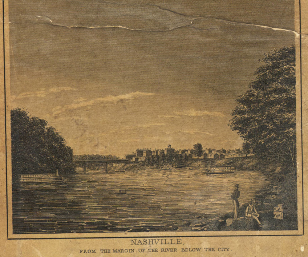
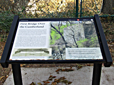
The Nashville Toll Bridge was torn down in 1851, but an abutment still stands on the river bank today. It's on property owned by the Tennessee Department of Transportation near the Victory Memorial Bridge, and is now a certified site on the Trail of Tears National Historic Trail. Interpretive signs tell the story of the bridge and the Trail of Tears.
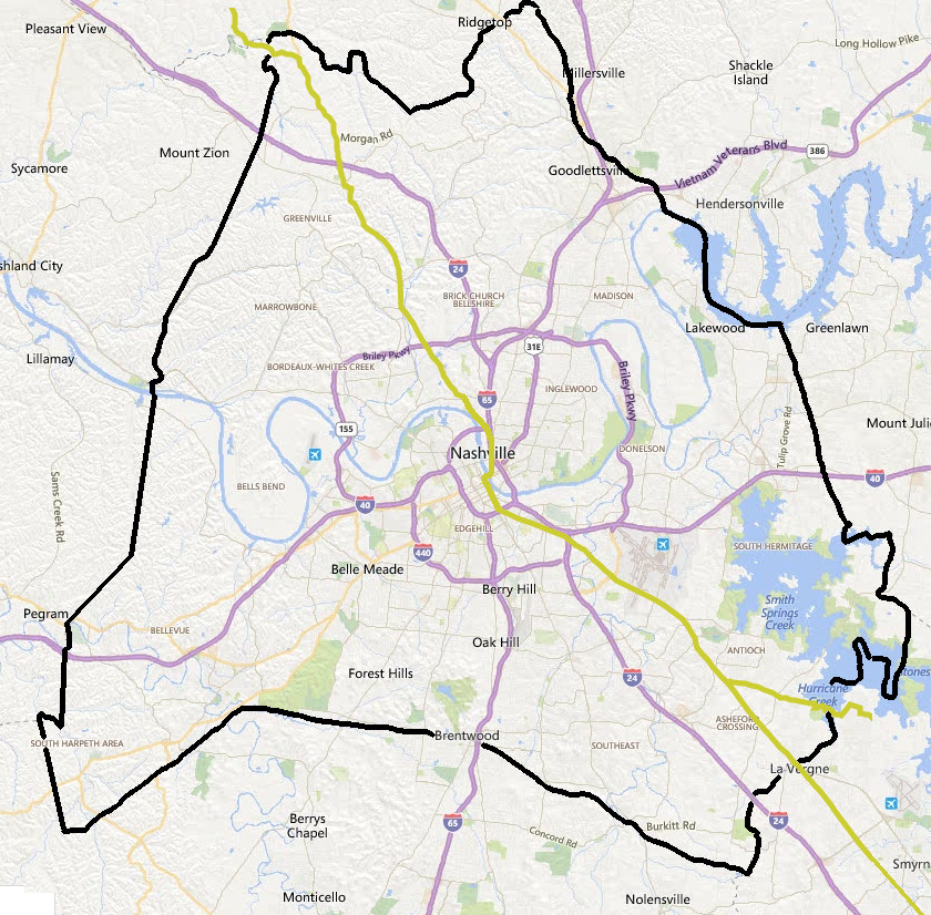
The approximate alignment of the the main or Northern route of the Trail of Tears National Historic Trail follows Highway 70S / Murfreesboro Pike into southeastern Davidson County and continues on to what is now Lafayette Street near downtown Nashville, turns north on to what is now 2nd Avenue, and continues on to the Public Square. From there the original route crossed the Nashville Toll Bridge, the only bridge across the Cumberland River at the time, to East Nashville. The TOTNHT follows James Robertson Parkway across the Victory Memorial Bridge, which stands almost in the same spot where the Nashville Toll Bridge was located. On the east side of the Cumberland the route turns north on what is now 1st Street, continues on to Dickerson Pike, then turns to the northwest in the approximate area of what is now Baptist World Center Drive, and continues on to cross Trinity Lane on Whites Creek Pike. The route follows Whites Creek Pike to the northwest and crosses Briley Parkway, Old Hickory Boulevard, and Interstate 24, then turns to the west on what is now Coopertown Road, and continues on into Cheatham County.
Maps of individual Trail of Tears National Historic Trail sections in Davidson County:
Murfreesboro Pike From the County Line To Mt. View Road
Murfreesboro Pike From Mt View Rd To Una Antioch Pike
Murfreesboro Pike From Una Antioch Pike To Briley Pkwy
Murfreesboro Pike From Briley Pkwy To Elm Hill Pike
Murfreesboro Pike From Elm Hill Pike To N 1st Street
Whites Creek Pike From Trinity Lane To Briley Pkwy
Whites Creek Pike From Briley Pkwy To Old Hickory Boulevard
Whites Creek Pike From Old Hickory Boulevard To Seymour Hollow Rd
Whites Creek Pike From Seymour Hollow Rd To I_24
Whites Creek Pike From I_24 To Coopertown Rd
Sources
(Click to open/close the list)
Trail of Tears National Historic Trail Maps, National Park Service
Major General Winfield Scott's Order No. 25 Regarding the Removal of Cherokee Indians to the West,
National Archives Catalog, Item 6172200
The Trail of Tears
In Tennessee: A Study of the Routes Used During the Cherokee Removal of 1828. by Benjamin C. Nance, published by Department of Environment and Conservation Division of
Archaeology 2001.
"Proposition Of Cherokee Delegation To General Scott, July 23, 1838" by John Ross, Elijah Hicks, James Brown, Edward Gunter, Samuel Gunter, Situwakee, White Path, and R. Taylor,
House Documents, Otherwise Published As Executive Documents: Twentyfifth Congress, Third Session, 1838: pg. 429-430. Digitized by Google Books.
"General Winfield Scott To John Ross, E. Hicks, J. Brown, E. Gunter, S. Gunter, Situwakee, White Path, and R. Taylor",
House Documents, Otherwise Published As Executive Documents: Twentyfifth Congress, Third Session, 1838: pg. 430-431. Digitized by Google Books.
"Cherokee Removal: The Journal of Rev. Daniel S. Butrick, May 19, 1838-April 1, 1839", The Baptist, Volume IV, by Daniel S. Butrick, Trail of Tears Association, Oklahoma Chapter, 1998, pages 46-47.
"The Emigrating Cherokees", The Baptist, Volume IV, edited by Robert Boyte C. Howell, published by W.H. Dunn, 1838, pages 357-359. Digitized by Google Books.
Related Links
(Click to open/close the list)
The Indian Removal Act of 1830
The 1823 Nashville Toll Bridge
The Old Jefferson Site
Exile's Communion - Trail of Tears In Nashville
Thousands of Cherokees Passed Through La Vergne on Trail of Tears
Stones River National Battlefield
Pulaski / Giles County Trail of Tears Memorial
Port Royal State Historic Park
David Crockett State Park
Cherokee Removal Memorial Park
Red Clay - TN History for Kids
Moccasin Bend National Archeological District
Chickasaw Treaty Council Of 1830
Cherokee Heritage Sites In Southeast Tennessee
Trail of Tears Association
Trail of Tears National Historic Trail - National Park Service
Trail of Tears Tennessee Map and Guide - National Park Service brochure
Trail of Tears National Historic Trails Map.
Books: (The Native History Association is an Amazon Associate. If you buy using one of our Amazon Book links, we get a small percentage of the sale, and we appreciate that support.)


